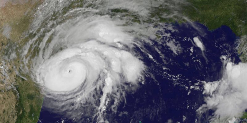
After dumping nearly 50 inches of rain on parts of Southeast Texas and leaving the Houston area in a shambles, Hurricane, now-Tropical Storm, Harvey might finally be moving on.
Harvey’s reign of terror in Texas has been marked by two main features: an overwhelming, mind-boggling amount of rain, and a refusal to move as most hurricanes will. The storm has inched along since it came out of the southern Gulf of Mexico and slammed into the Texas shoreline just above Corpus Christi, and since making landfall northeast of Port Aransas on Friday night it has moved less than 200 miles to where it currently sits a bit east of Galveston.
That isn’t normal. Most hurricanes will slam into the coastline and then head inland, usually getting picked up by the jet stream and moving out of the area. They’ll do damage, but the majority of flooding they cause comes from storm surge, not rainfall. Or they’ll scrape along the coastline and churn up lots of shallow water along the way, causing damage that way.
Not this one. This came ashore as a Category 4 storm with all the attendant wind and storm surge damage to Port Aransas, Fulton and Rockport, not to mention Corpus Christi itself, and then went a little inland and essentially camped out southwest of Houston, battering the nation’s fourth-largest metropolitan area with over four feet of rain in less than five days. If you were to engineer a worst-case scenario from a hurricane, you’d be hard-pressed to come up with anything more destructive – and, frankly, improbable. The expectation would be that this storm would have come ashore and then quickly swept to the northeast once it got over, say, San Antonio. Had it done that, damage outside of the Corpus Christi area would probably have been minimal.
The reality has been creeks and bayous and rivers inundating populated areas, reservoirs overflowing and having to be released, adding floodwaters to already submerged areas, and levee failures.
Advertisement
But finally, there’s some hope for relief. Here was the forecast track released at 4 p.m. central time by the National Hurricane Center…
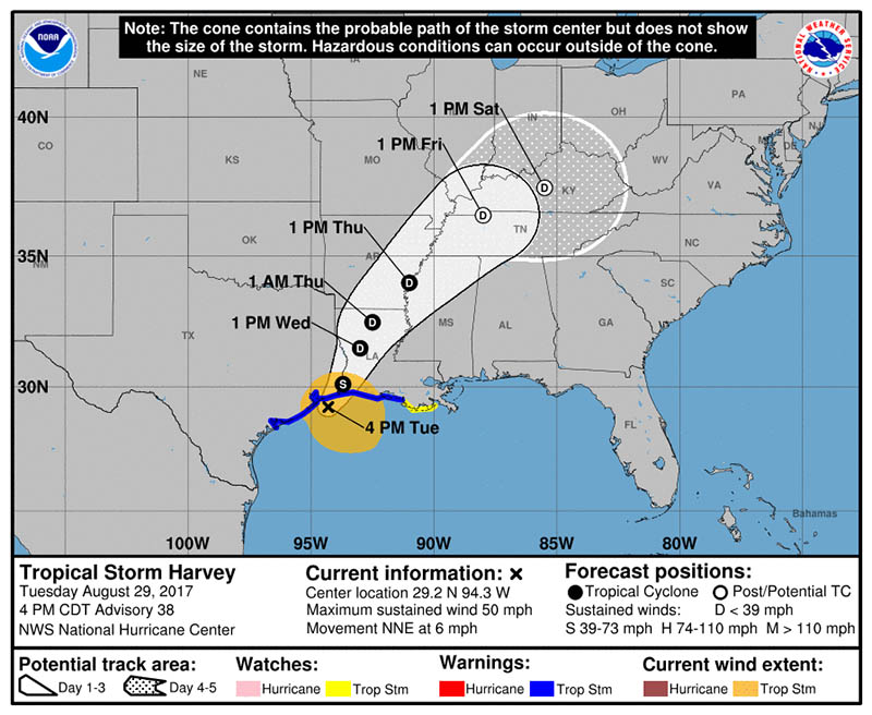
The track shows the storm accelerating fairly quickly, at long last, and getting the hell out of Texas. It will make a trek through western Louisiana, but at a speed fast enough to avoid too much more damage than it has already done. And by tomorrow morning it will have weakened to a tropical depression.
Meaning that by the end of this week it will be time to do damage assessments and begin the recovery throughout southeastern Texas and into southwestern Louisiana, where there has been flooding as well. We’re all going to be very glad to see Harvey gone.
Advertisement
Advertisement